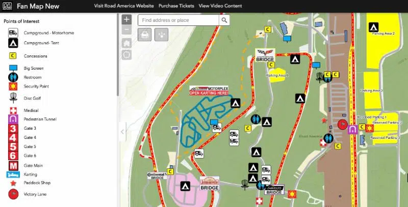
Road America today unveiled several interactive maps that assist fans, competitors, campers and fitness enthusiasts attending events.
The new maps include interactive elements to help fans navigate their away around America’s National Park of Speed, while providing helpful information on concession stands, restrooms, disc golf, camping areas and much more. Users are able to change the topography and pinpoint their location using GPS while sharing campsite locations or fitness routes with friends.
“With this web-based tool, our fans can easily see and learn how to navigate around the grounds at Road America,” said Senior Vice President, Mike Kertscher. “Each map includes all sorts of useful information for public use, from the smallest buildings, to the Four Miles of Fitness routes and each offers a quick way to find concessions, campgrounds, disc golf, karting and viewing locations around the facility.”
The idea for the new maps came from within Road America’s marketing and management team, which spent four months working with McMahon Associates, Inc., to bring the maps from concept to launch. These are the first maps of their type offered by an entertainment venue and racecourse such as Road America.
All of the new Road America “Interactive Maps” can be visited using any device with a web browser including desktops, phones and tablets. By checking criteria fields, and using the legends and layers, fans can find recreational opportunities, campsites, concession stands plus viewing locations while sharing data with friends.
Several maps are available, to view the free, interactive maps, visit:


